16
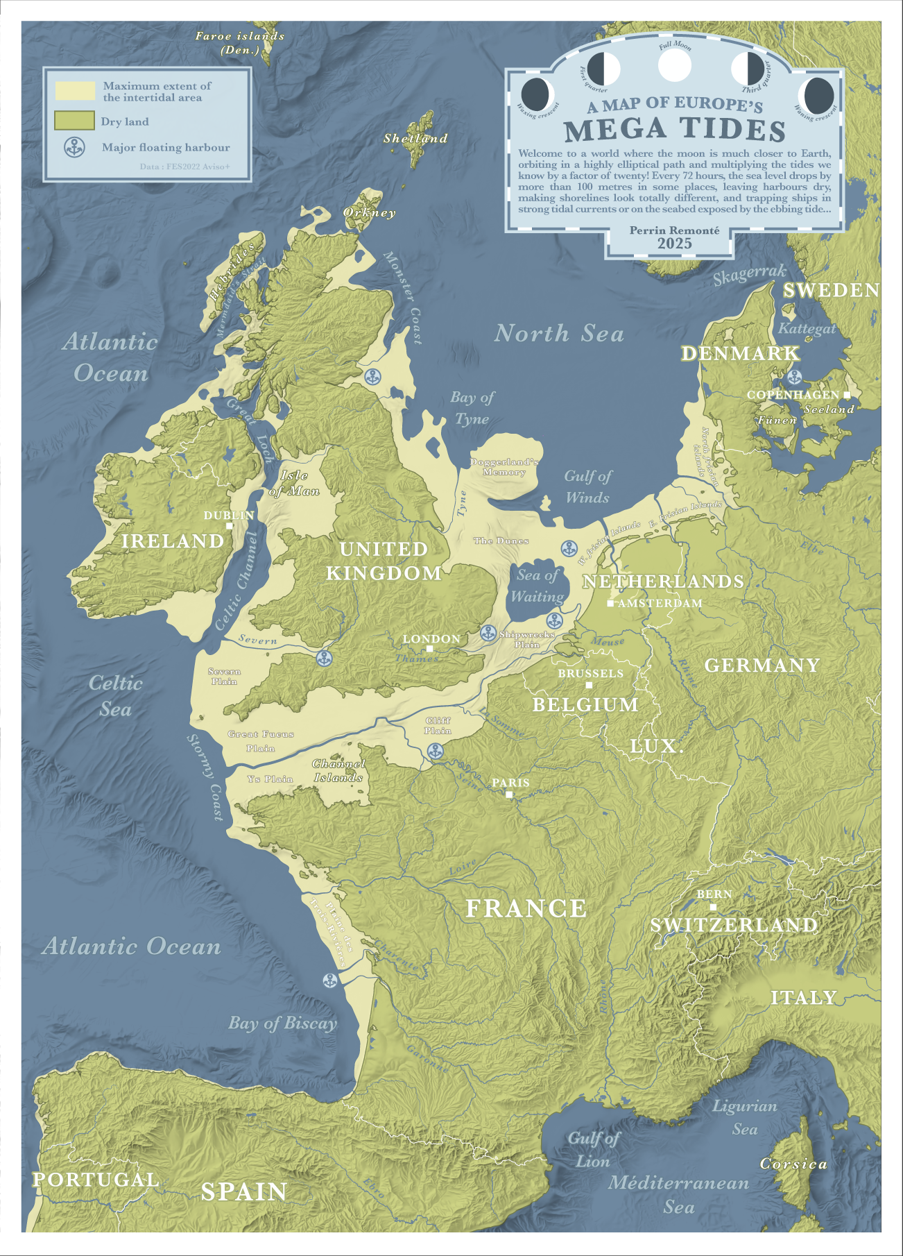
Wouldn't the tides go up and down? map seems to show down only
Wouldn't the tides go up and down? map seems to show down only
I understand it as both, as the tides would occupy the yellow zones when up
But the green zones are current shorelines.
Author's comment to that question: https://old.reddit.com/r/MapPorn/comments/1l1aga3/europes_mega_tides_what_if_tides_were_20_times/mvjomt9/
Their answer is "idk lol".
Which means they didn't consider it. Of course lower low tides also mean higher high tides, the water has to go somewhere.
At least we can go visit doggerland finally!
Erm ... if in such a scenario sea-level drops 100m below current shoreline at low tide, wouldn't it rise nearly 100m at high tide - assuming the total volume of the ocean being the same ? In which case the dry-land coastline would be much further inland.
Fun map! The spelling of the Danish islands is weird though, looks like the German names?
A laid back community for good news, pictures and general discussions among people living in Europe.
Topics that should not be discussed here:
Other casual communities:
Language communities
Cities
Countries